Inspirations, disused rail routes

Post anything here that is related to taking Railway Photographs!

Moderator: saslord

User avatar
Zunnan
Posts: 1208
Joined: Mon Dec 03, 2007 2:54 pm
Location: On the cusp of spaghetti...B23

Re: Inspirations, disused rail routes

Post by Zunnan »

I still can't believe that I forgot to take BOTH of the SD cards for my camera :roll:

I've had a sift through the OS maps I managed to recover, and a 1954 date stamped map has a 1977 GPO update showing the A444 bridge crossing the line followed by a single line level crossing at Heath Road, which is where those two rail ends are poking out of the ground behind that bus stop. The Bedworth Bypass was started in 1968, so my guess is that the bridge was actually built in '68-'69, and that tallies nicely with my guess of around 1970 earlier today while we were standing beneath it. Production ceased at Newdigate in 1982, so my guess is that the line was lifted in 1983, I haven't yet found anything more specific than that although I do now posess plans for the full colliery layout as it was in 1973 with GPO boundaries updated in 1977. :D

I'm working in Bedworth for the next 1.5-2 weeks so if/when I get the chance to take an extended lunch break while waiting for the cables to repressurise (if I plan things right) I'll pop back down to the line and walk the few hundred yards from the Coventry Road bridge in the other direction towards what was the canal wharf and see whats left. Its only down the road from the exchange afterall. I wonder if I'll get stopped by that PCSO again! :lol:
Under Construction N Gauge dog bone.
Canon Street. N Gauge
The Workbench.
0121modeller
Posts: 1205
Joined: Sun Mar 09, 2008 1:16 am
Location: Erdington, Birmingham,.... but can also be found at various railway bridges !

Re: Inspirations, disused rail routes

Post by 0121modeller »

North west Walsall re-visit, this time to disused route limit of Ryecroft junction.
I re-visited this location with the intentions of getting that wheelie bin (seen arrowed in this photo from last month on my 1st visit) , Unfortuately the bin was no longer there as someone had manged to get it over the fence prevents access through underside of that bridge. the bin was also now missing its lid :(
Image
Not a wasted journey, as I'd purposely bought along my camera as at some stage I meant to make a return visit to explore this disused rail route more (both directions) .
I parked my car up on the George Stephenson pub car park which is about the middle of the disused rail route, its also where that blue plate girder footbidge is with the Sainsbury's store the opposite side of bridge.
When I got back home, I made the map (below) to the best of my ability...
Image
Next few posts will relate to my walk eastbound towards Ryecroft Junction. Before now I doubted the remains of route..., I was pleasantly suprized it was all there & do-able.
Image
I poked my camera through the gap in the fence as to get this shot of brick arch bridge with nice curved wing walls, all in English bond using engineers blue brick.
Image
Corner of Green Lane & Cable drive** (**= road into industrial estate that runs parallel with a section of this old rail route) , the area of cutting was fenced off, but gate was unlocked ! :shock:
Image
I made my way down the steep embankment into cutting, looking up ahead does'nt seem too badly overgrown, compared to behind me towards that brick arch bridge
Image
Some sort of brick building to my LH side.
Image
Bridge repairs at Bloxwich Road, the scaffolding made it a little awkward to go through, as to find an alternative route to the other side I easily climbed up the embankment but I was blocked from getting to road/footpath by a newly errected 6ft high metal fence.
Image
A couple of bridge abutments seen here, maybe for what was a roadbridge ? ..., as there's no indication of a rail route crossing over here according to my 1970 street atlas, but maybe a rail link once did cross here long ago, I'll have to get the Allen Godfrey maps for this area.
Image
Another bridge undergoing repairs with scaffolding to the underside, looking at my road map the bridge carries Proffitt street.
Image
I came across this, I think it must be some sort of observation post for monitoring water/moisture levels within the cutting, the label on top states "do not fill"
Image
The ground was fairly boggy in parts & smelt like a swamp. The fenced off bridge at Mill street & what looked like heavy overgrowth ahead, so now was the time for me to get out of that cutting.
Image
Mill street bridge. As said, I could go no further at this stage, Luckily there was a convenient route as to climb out of the cutting & photo here (above) is a good shot of the bridge & its arches.
Behind & over to the LH side of me the was the "in use line" towards Henesford & Cannock.
Image
The route I'd being following in photo's above would've been just to the LH side behind me in this photo.
Image
At Ryecroft junction, A view from North Street, a train of ballast top & tailed by class 66's take the freight route (RH side tracks) via Aldridge & Sutton park.
Last edited by 0121modeller on Mon May 30, 2011 1:02 pm, edited 1 time in total.
Scratchbuilding 4mm scale JXA scrapwagons ; - http://www.newrailwaymodellers.co.uk/Fo ... =6&t=37620
Scratchbuilt & kit built grappler claw cranes ; - http://www.newrailwaymodellers.co.uk/Fo ... =6&t=36342
0121modeller
Posts: 1205
Joined: Sun Mar 09, 2008 1:16 am
Location: Erdington, Birmingham,.... but can also be found at various railway bridges !

Re: Inspirations, disused rail routes

Post by 0121modeller »

Continued route from above post, (this time from Sainsbury's going westbound)
Image
Sainsbury store starting point referance. See my hand drawn map/photo. ... OK, OK, :oops: .
Image
I parked my car at a nice looking family/restaurant type pub car park just visible in this topside plate girder bridge photo.
I had just walked back from the Ryecroft half of route (to the RH of this photo, accessed by walking)
Image
What lies westbound ahead of this photo seen in a previous post on this thread in a moment... See my hand-drawn map below :) , in this post we start from Sainsbury's towards the M6 motorway.
Image
Looking at my A-Z scale mile referance I had walked about 6 miles total (as its there & back). From the M6 to Ryecroft jct is approximately 3 miles.

Image
A closer look at that concrete & steel bridge. , nice interlocking shaped concrete blocks for wing walls, typically modern-ish.

Image
National grid site., Behind me is the Reedswood way (road) that serves the retail park (Matalan, Focus DIY, petrol station & Sainsbury's)
But years ago, here behind me, AFAIK looking at my 1970's map was once the site of a coal-fired power station.

Image
People not familiar or no knowledge of history for this area, well, who would've guessed this was a former rail route ? :shock:
This photo is especially nice with natures natural carpet
& those evergreen trees look lovely too, landscape re-generation for this area in particular is obviously well maintained.

Image
Concrete bridge, the trackbed starts to rise here.
Image
Concrete bridge goes over a footpath to modern housing estate.

Image
Heading towards the Bloxwich Road, trackbed rising here to abutment seen in next photo, I climbed down the embankment back onto Reedswood Way here, as ahead was too overgrown & the abutment was only a few metres away anyway (photo below).
Image
Bloxwich road (facing north) Level of overgrowth visible on the abutment.

Image
& the opposite side of Bloxwich road showing what remains of that abutment. The M6 motorway is a few metres beyond the area to my LH side. Heres where the westbound route ends..., However..., there may still be traces at various locations worth following up the other side of M6 towards Wolverhampton, I'm really not sure, but anyway thats for another day.

Dave.
Scratchbuilding 4mm scale JXA scrapwagons ; - http://www.newrailwaymodellers.co.uk/Fo ... =6&t=37620
Scratchbuilt & kit built grappler claw cranes ; - http://www.newrailwaymodellers.co.uk/Fo ... =6&t=36342
User avatar
Zunnan
Posts: 1208
Joined: Mon Dec 03, 2007 2:54 pm
Location: On the cusp of spaghetti...B23

Re: Inspirations, disused rail routes

Post by Zunnan »

To conclude Daves post of the Newdigate Colliery Branch, this is the missing section from the BR line through Bedworth as far as the Coventry Road where his post begins.

The branch began 500 yards or so to the south of the current Bedworth Station, and its existance continued until closure of the colliery in 1982, although I believe lifting took place a little later.

Image
The site of the old junction is now heavily overgrown, I assure you this is the right spot facing due North. And yes, the bullrush is in knee deep slushy ground, as my legs will testify in reaching this spot by wading up the old cess rather than to tackle the Hawthorn now occupying the trackbed here. The current Coventry - Nuneaton line is on the other side of the fence poking from the undergrowth to the right.

Image
It doesn't look like much, but this is the trackbed facing Southwest not 20 yards from the location above. After the trek up the cess I decided I prefer dealing with Hawthorn afterall...

Image
Definately on the right track, a burrowing animal has unearthed an old bolt and dumped it unceremoniously for all to see. There is a definate shoulder to the trackbed at this point as it curves sharply to the West.

Image
The trackbed soon begins to open out, and Hawthorn gives way to nettles instead.

Image
Before long the trackbed enters open parkland which was what appears to be exchange sidings on old maps dated 1954 I rescued from a skip at work. The course of the line can be seen as mowed grass curving away to the left, the path dropping steeply down to the right was once the course of the line to a wharf for transhipment to canal.

Image
This old tub is also at the above site, mounted on a short piece of what appears to be 24" gauge track.

Image

Image

Image
A stump of the old canal arm still remains, although certainly not navigable. It has been trunkated before it crosses under the Coventry - Nuneaton line, the land beyond the line has been reclaimed and now stands about 15' above the water level although a path along the old siding up to the branch still exists.

Image
The run up to the branch is noticably steep even on foot, and there are documented cases of the often gravity worked wagonloads getting away from their shunter, as shown HERE.

Image
Back on the 'main' and now about 50 yards to the West of the photograph of the tub and the trackbed is still rising quite steeply having now left the site of the exchange sidings.

Image
This is the former bridge at Coventry Road, I remember when it was still a bridge but I can't remember exactly how long ago that was. Today it can be seen from Coventry Road as two lone pilasters standing on the East side of the road with the West side still having a complete parapet, although hidden behind a substantial billboard.
Under Construction N Gauge dog bone.
Canon Street. N Gauge
The Workbench.
User avatar
Zunnan
Posts: 1208
Joined: Mon Dec 03, 2007 2:54 pm
Location: On the cusp of spaghetti...B23

Re: Inspirations, disused rail routes

Post by Zunnan »

Marton Junction to Southam

Dave and myself have decided to start venturing a little further from home in our search for disused railways. For the first time we took mountain bikes in order to cover more ground, so as well as the bridge here, we also covered the remaining branch to Southam Cement which closed in the mid '80s.

Image
The Ridgeway Lane bridge is still an imposing structure, I'll leave it hidden in this silhoutetted image for now as we're going to return for the Leamington to Rugby route at a future date.

Image
Marton Junction as it appeared yesterday, quite a difference to the final year in existance as seen here from a similar viewpoint. The branch to Southam bears away to the right, Rugby lies straight on.

Image
A few hundred yards along from the junction and the trackbed is still very passable, if a bit rough riding on a bike. Most of the ballast is long gone, but there is a lot of clinker lying around. In the few places where a ballast shoulder was actually found in the undergrowth, it seems that the branch was covered in a 50:50 mix of fine ballast to clinker.

Image

Image
The bridges along this route are still largely in tact. A missing pilaster here and there and some quite significant cracks in abutments perhaps, but by and large they're all still there. This is the first bridge on the route serving as access to a private dwelling. Another near identical bridge is sited 400 yards away crossing Snowford Hill.

Image
After a further 1000 yards the River Itchen is reached, first crossed by the railway over this low 3 arch bridge. The river curves away through the fields nearby and before long the railway crosses it again.

Image
The second bridge over the Itchen is again a pleasant brick arch bridge, I'm sure I could just make out a third arch in the dense undergrowth of the North (right) bank.

Image

Image
Before long the railway crosses Stonebridge Lane, which is on the National Cycle Route 41. Beyond this bridge, Route 41 occupies the trackbed for a distance, and the going becomes very easy indeed.

Image
Route 41 leaves the trackbed just before the trackbed crosses the Grand Union Canal at Long Itchington, and once more the trackbed goes back to loose clinker, nettles, brambles and hawthorn. It's still passable on a bike however, although its a bit more enclosed by now; wear gloves if you don't want to get repeatedly stung from here on!!

Image
The route once again crosses the Itchen, this time in spectacular fashion on a 5 arch viaduct in close proximity to the canal crossing. The trackbed is still passable, although clearances are a little tight until the route passes into a cutting on the approach to Southam. As the A423 is approached the trackbed really bogs down, to the point that Dave and myself had to dismount and pick our way along the embankment sides.

Image
Once the A423 was passed the trackbed soon dries out again, and in the distance looms the now defunct cement works that kept the branch open long after passenger operations ceased.

Image
Image
The final bridge on the route is just beyond the cement works which carried the line over a drainage ditch and pipeline. In the final years this was just a headshunt for the works, and the trackbed ends soon afterwards as it reaches Stockton Road. The trackbed onwards to Daventry between here and the A426 has long been obliterated, but once the A426 is crossed it appears to be traceable, but I don't think it's going to be as passable as the route has been up to this point.

Image
With the weather fast closing in, its time to turn around and head back to where we parked the car on the outskits of Leamington Spa. We didn't get far before getting drenched!
Under Construction N Gauge dog bone.
Canon Street. N Gauge
The Workbench.
User avatar
SouthernBoy
Posts: 1753
Joined: Sun Oct 08, 2006 11:01 pm
Location: The past: We do things differently there

Re: Inspirations, disused rail routes

Post by SouthernBoy »

Some really interesting and inspiring pictures here - keep them coming :)

Near where I used to live in Surrey were the London Necropolis Railway's branch into Brookwood Cemetery, and the branch to Bisley (rifle) Ranges, which also served the military camps around Deepcut during wartime. From memory very little evidence remains of these now but I'll try and get some pictures next time I'm in the area.
0121modeller
Posts: 1205
Joined: Sun Mar 09, 2008 1:16 am
Location: Erdington, Birmingham,.... but can also be found at various railway bridges !

Re: Inspirations, disused rail routes

Post by 0121modeller »

Thanks Mark :D , Photographic imput of other disused rail routes in UK most welcome, I think Zunnan & myself have nearly covered most of the West Midland old routes , hence some of our posts venturing into our neighbouring counties, this route being in Warwickshire.

I'll say Zunnan certainly Knows his stuff ! , he seems to instinctively know where a petered out trail goes with just the smallest of clues ! :shock:
I've certainly learnt a lot from his wisdom on many aspects,- including; - finding & following disused trails by following tree lines on google earth maps, & When you've lost your bearings in the middle of no-where, theres no need for a compass for knowing which way is north, south etc, as just look where the sun is on the skyline depending on time of day.

Just a couple of my photo's here from the above route Zunnan & myself ventured;
Image
Well, not so much a photo, but a scan of another one of my hand drawn maps... :oops:
Image
Apparantly, as the (above & below) photo of a trail map illustrates, the route is a dedicated cycle route.
Image
Image
Here's my photo I took whillst stood on capstone of abutment at the bridge next to the site of the former cement works at Southam.
We ended our journey here, as the track route does'nt go much furthur on to be worthy of following as its been built upon leaving little or no walkable trail.
Just as well, our bikes caked in mud & clay & I had slow punctures in both tyres, luckily Zunnan had bought his bicyle pump, I'd bought my pump but with wrong adaptor :roll: , & we got caught in light rain riding back via the roadway, so glad to get back to my car as we'de rode approximately 12 miles in total.
I'll really need to get myself a decent bike with 26" wheels ! (bike I have only has 24") .

Dave.
Scratchbuilding 4mm scale JXA scrapwagons ; - http://www.newrailwaymodellers.co.uk/Fo ... =6&t=37620
Scratchbuilt & kit built grappler claw cranes ; - http://www.newrailwaymodellers.co.uk/Fo ... =6&t=36342
User avatar
SouthernBoy
Posts: 1753
Joined: Sun Oct 08, 2006 11:01 pm
Location: The past: We do things differently there

Re: Inspirations, disused rail routes

Post by SouthernBoy »

The Brookwood Cemetery Railway


Yesterday I went on a trip to follow the route of the London Necropolis Railway through Brookwood Cemetery.

Outline:
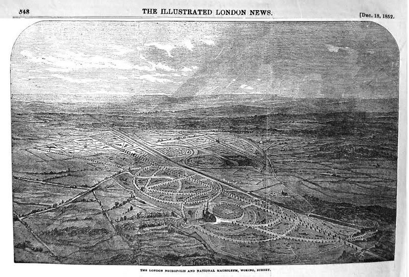
In the 1840s London had run out of space to bury its dead and the issue was causing much concern. In 1852 The London Necropolis Company was formed, and bought 2,000 acres of Surrey countryside to build a vast, landscaped cemetery.

Image

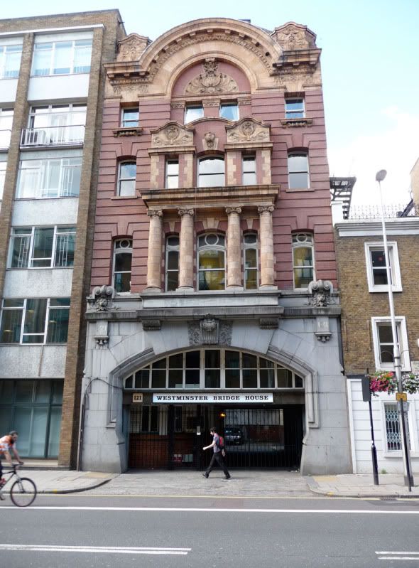
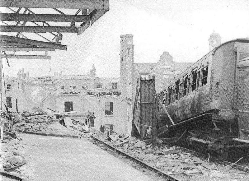
A railway terminus was built in Westminster Bridge Road, London, and it joined the LSWR main lines just outside Waterloo Station.

Image

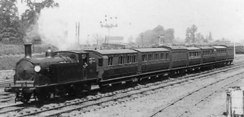
Funeral trains carried mourners and coffins to Brookwood (about 35 miles), and then took a purpose-built branch line into the cemetery.

Image

Here's the route the cemetery railway followed.
Along the top are the main lines from Waterloo, and below the cemetery line branches off.

Image

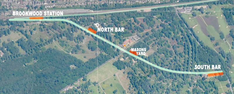
There were two stations, North Bar and South Bar (possibly the only fully-licensed premises in a cemetery, anywhere).

Image

There was also a siding into a monumental-stone-masons yard.

The service operated until the London terminus was destroyed in an air-raid in 1941.

Image

In the cemetery the tracks were lifted, and North Bar station was demolished in the 1960s. However, South Bar station remained open and continued to serve refreshments to customers into the late 1960s. The station later fell fowl of vandalism and arson attacks and is no more.

---------------------------------------------------------------------------------------

Today:

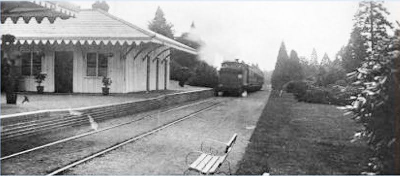
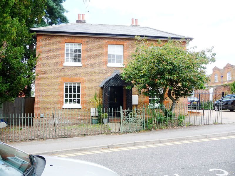
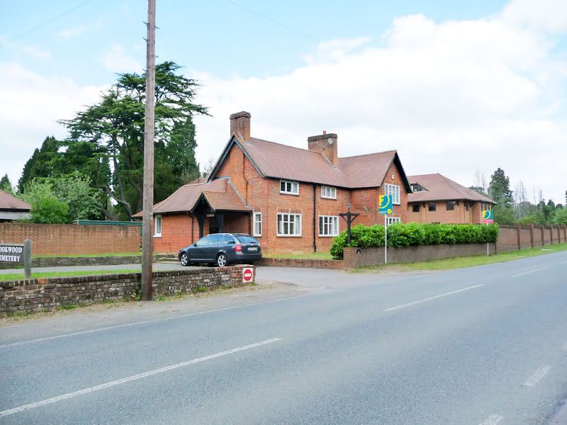
We start at Brookwood station and the delightful Station Master's house.

Image

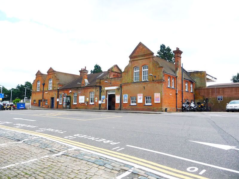
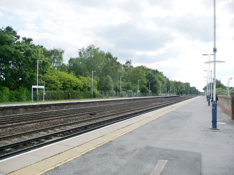
Here's the station, opened in 1864.

Image

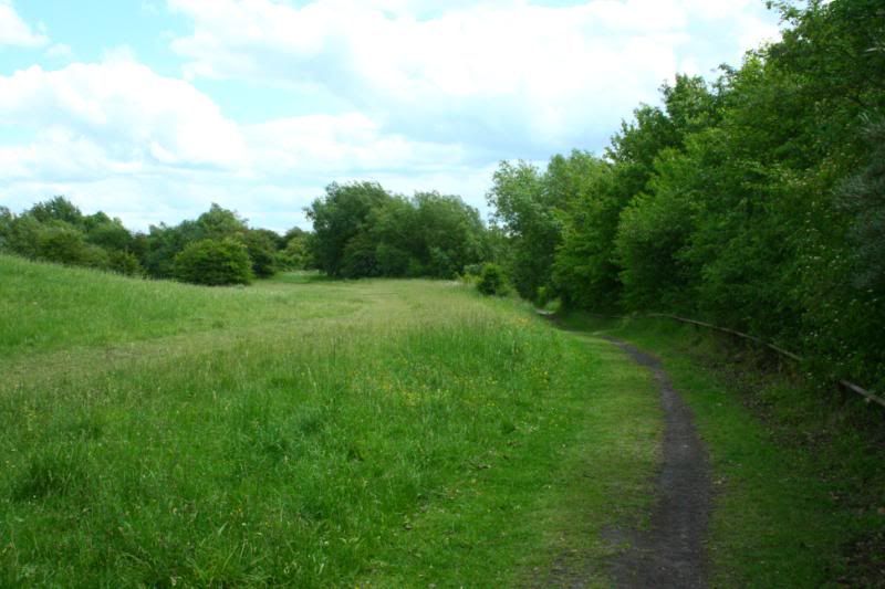
The next picture shows the up-platform on the left, down platform on the right.

Image

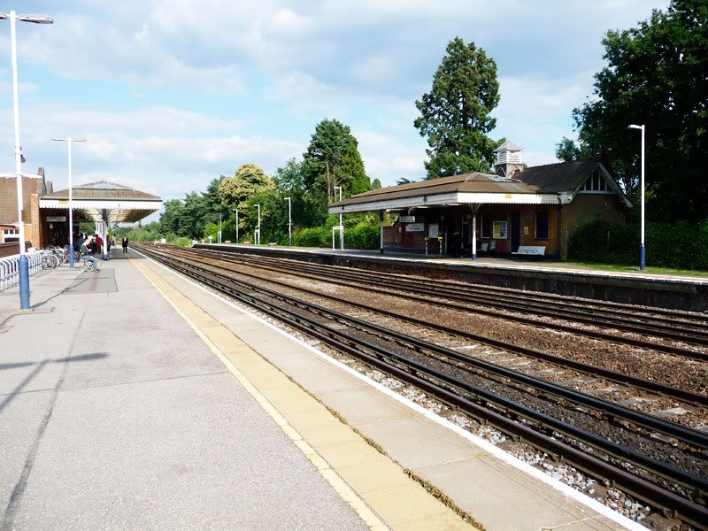
Looking down the line, on the right of the platform are the remnants of a bay platform which once served the popularly named 'Bisley Bullet'. That route will be the subject of a future post.

Image

Opposite is the down platform. At the far-end were a set of points over which funeral trains reversed and took a slope behind the platform down to the cemetery line.

Image


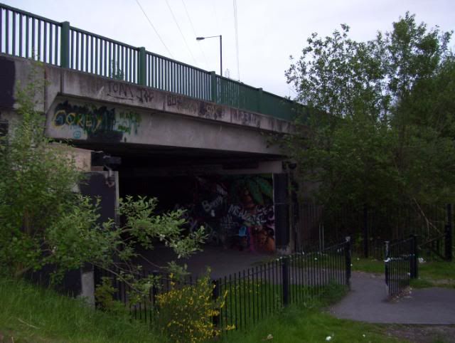
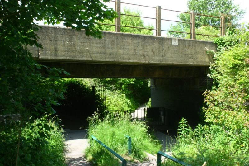
We take the subway ...

Image

Image


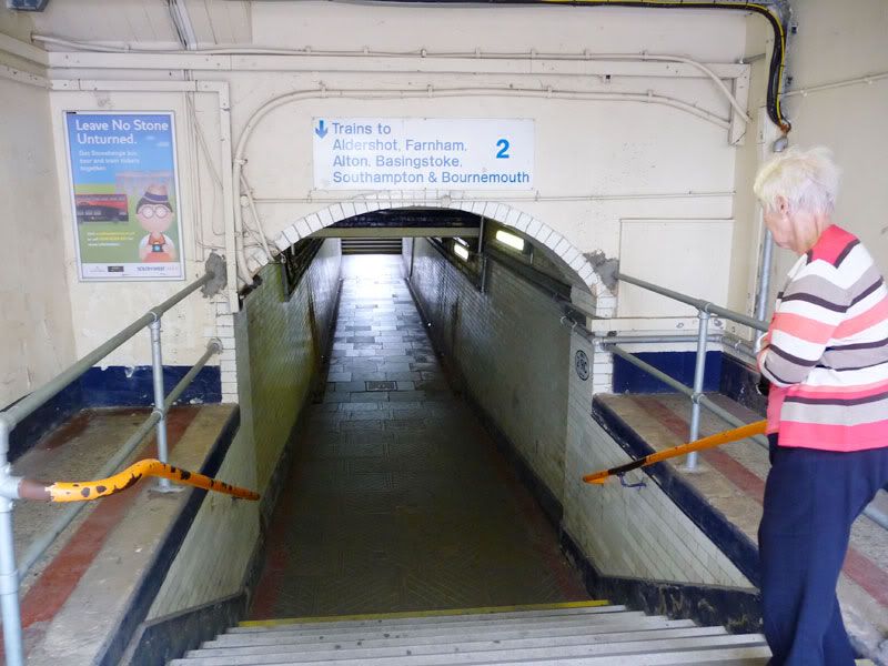
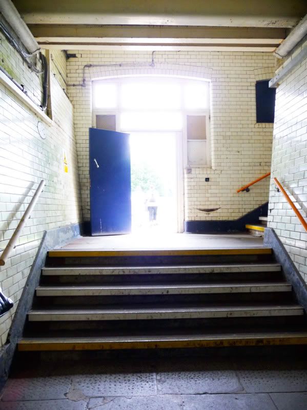
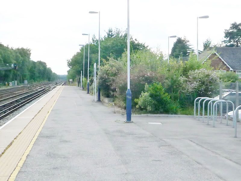
... and back into the sunshine. The track ran parallel with the back of the building, and there was a runaround loop here.

Image

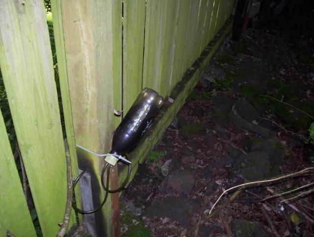
In the bushes to the right of the door is this section of track. It's not original and has only appeared in recent years.

Image

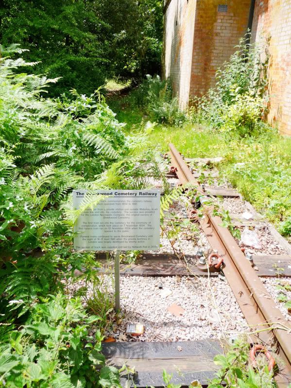
To the left is the route of the line - it's now fenced off, but it didn't used to be. And a fence isn't getting in my way :)

Image

The line ran along the length of the down platform.

Image

Here's the back of the platform.

Image

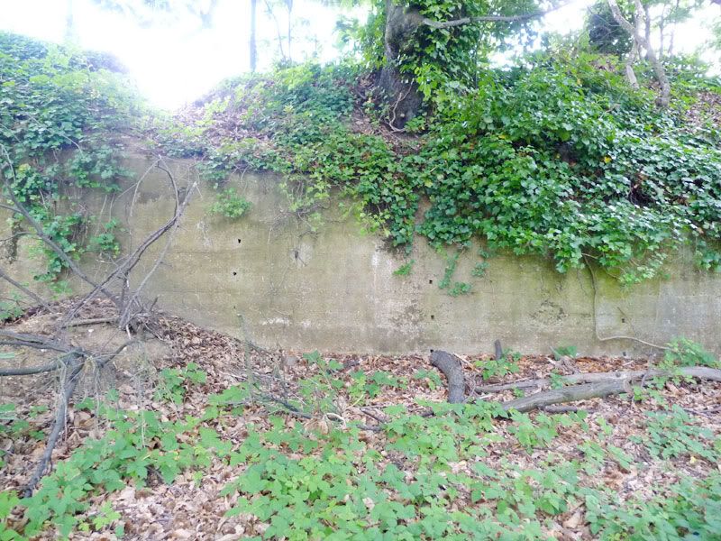
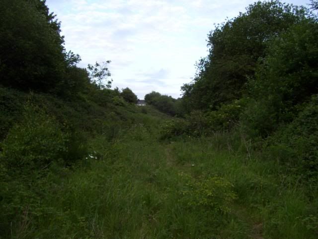
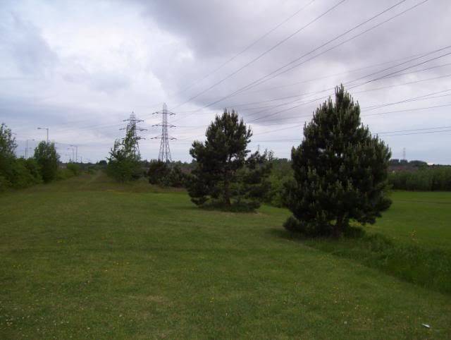
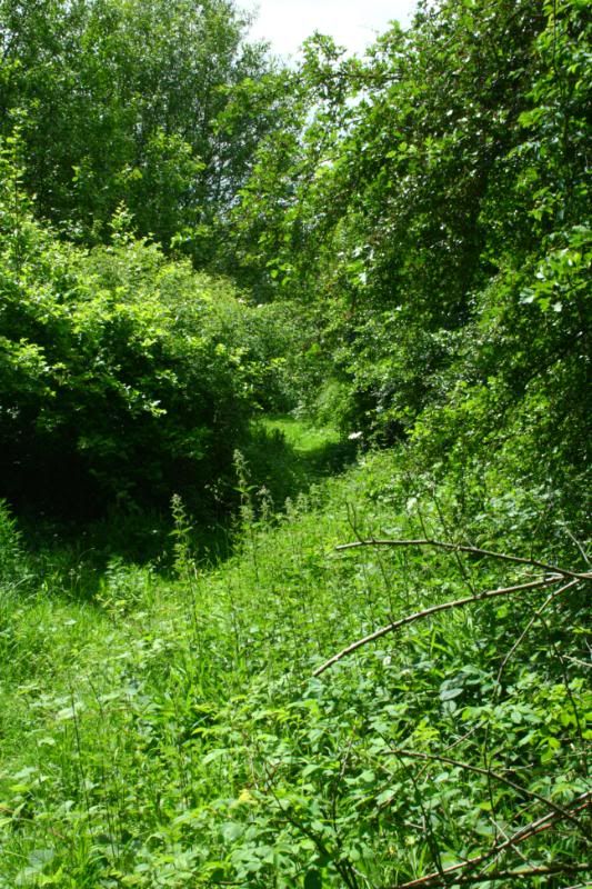
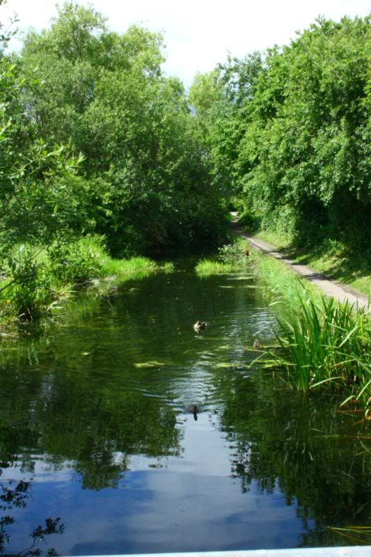
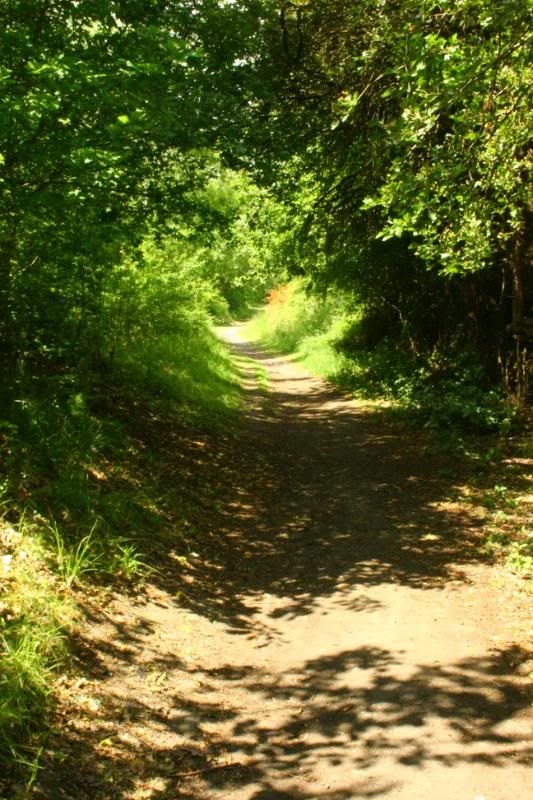
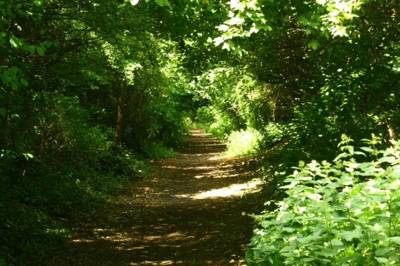
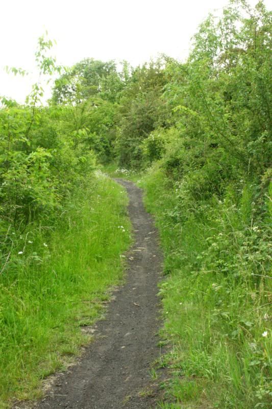
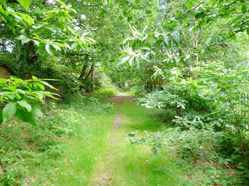
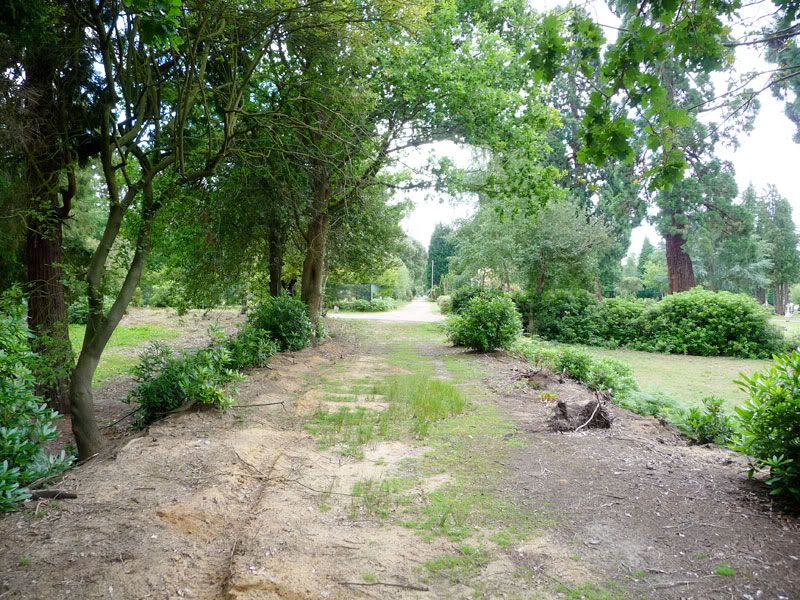
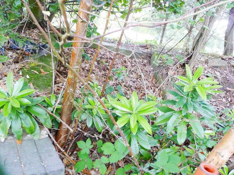
After a hundred yards or so the line curves gently right. To this point the line has been on a shallow embankment. Originally it was bordered by ornamental shrubs - some of which are now very large trees!

Image

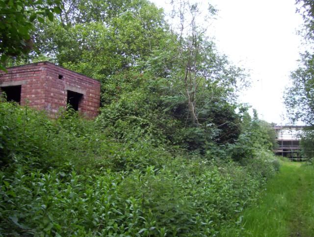
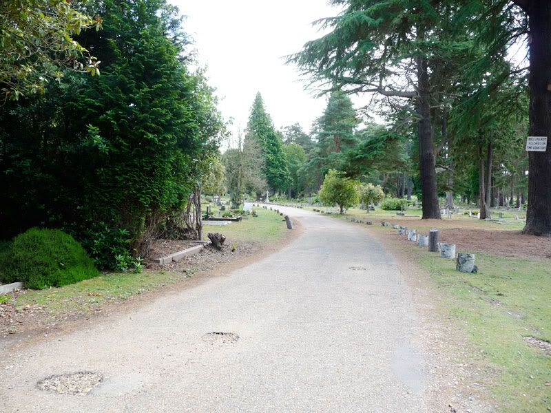
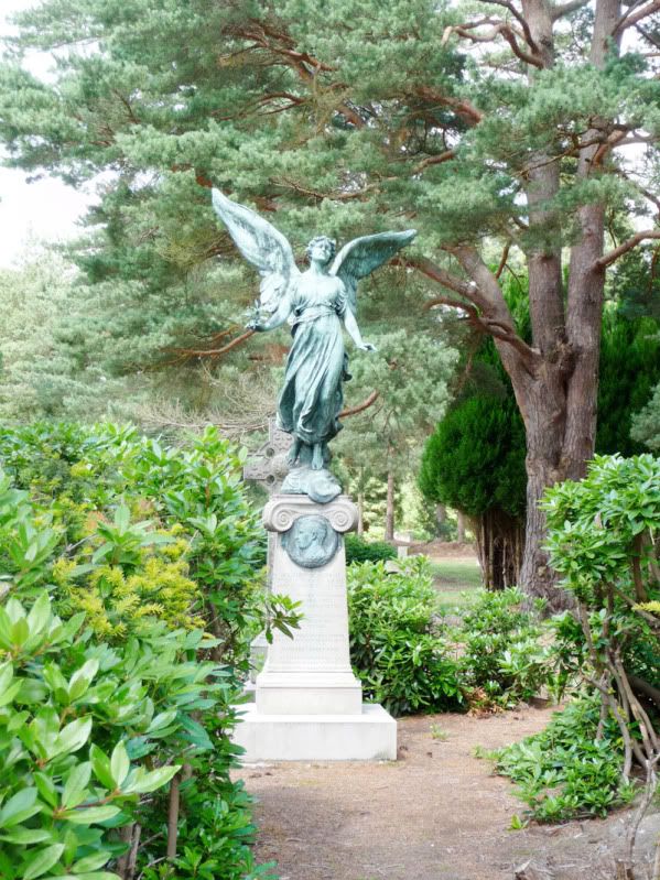
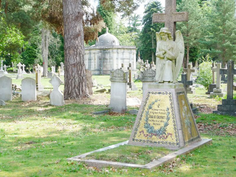
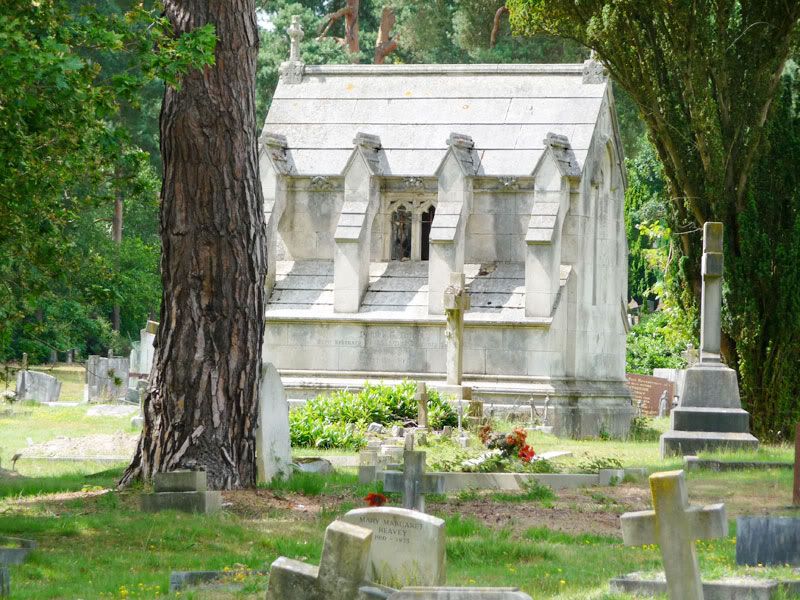
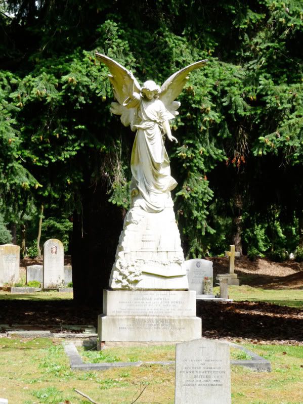
There are delightful chapels and monuments everywhere.

Image

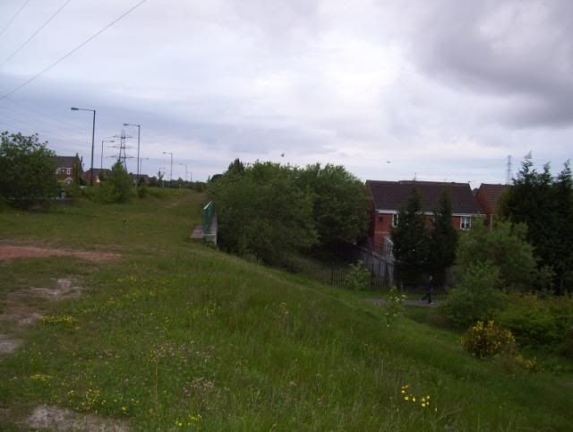
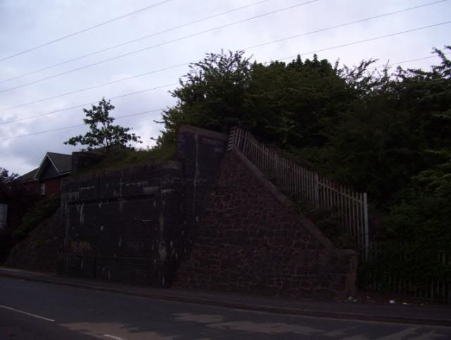
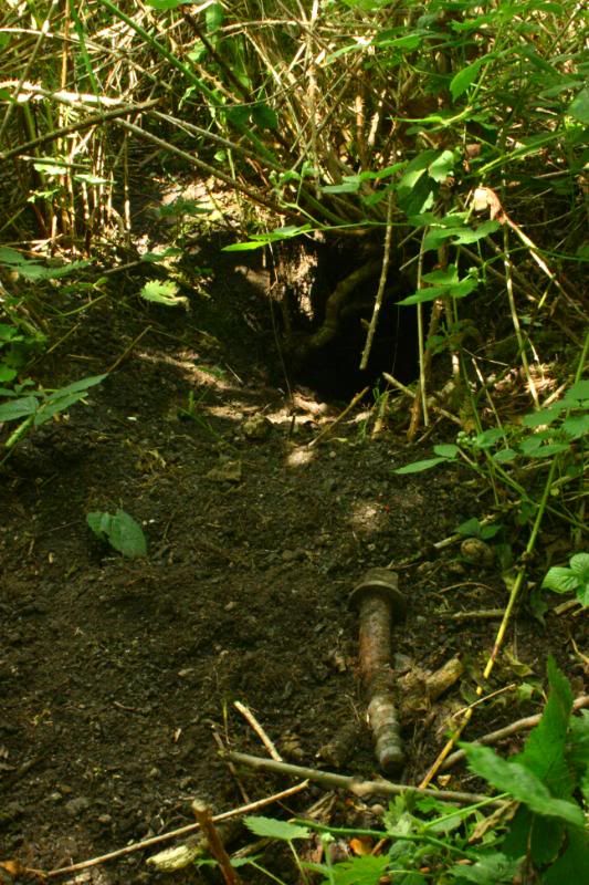
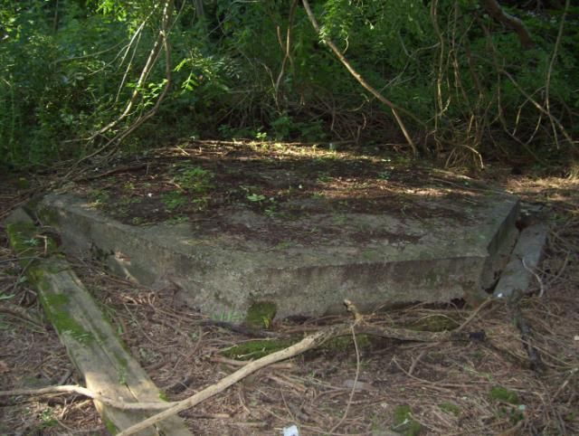
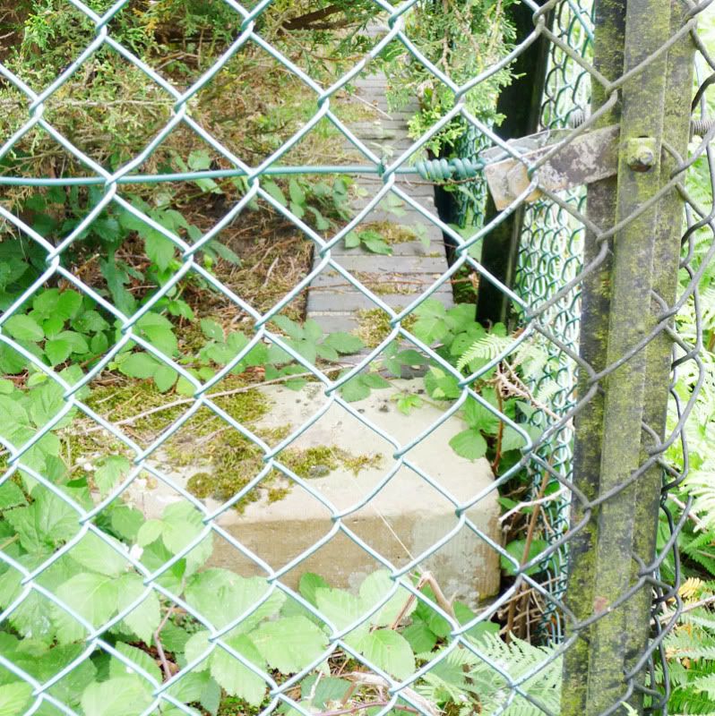
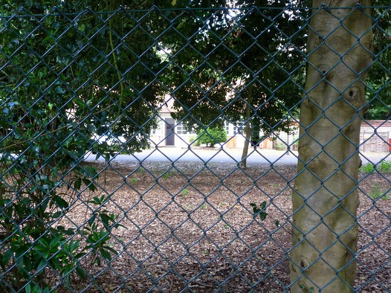
Here we're approaching North Bar station. The fenced area centre-left marks the platform itself.

Image

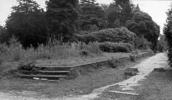
In the 1960s it looked something like this.

Image

Here are the steps at the near-end.

Image

At the far end there were also steps, although these were narrower and formed a quarter-turn from platform to ground-level. You can just make them out here.

Image

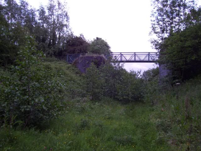
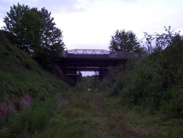
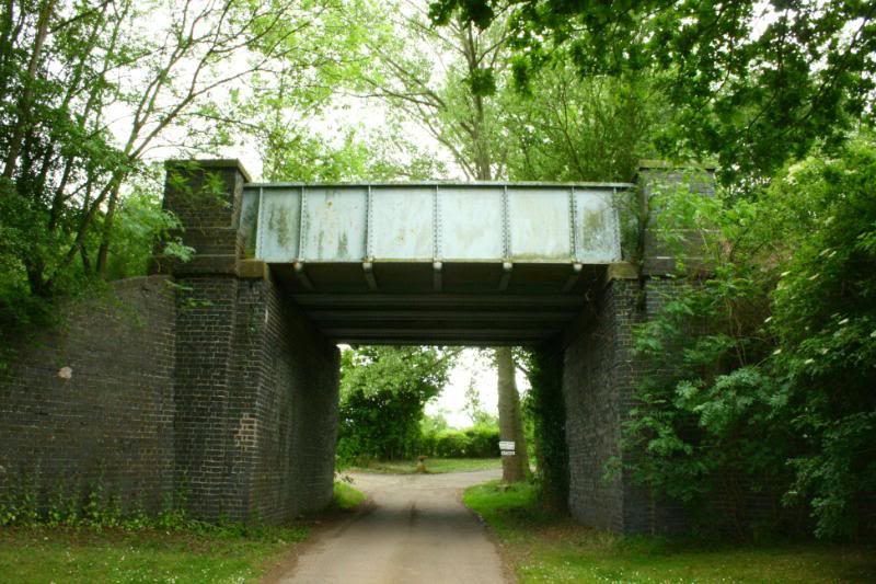
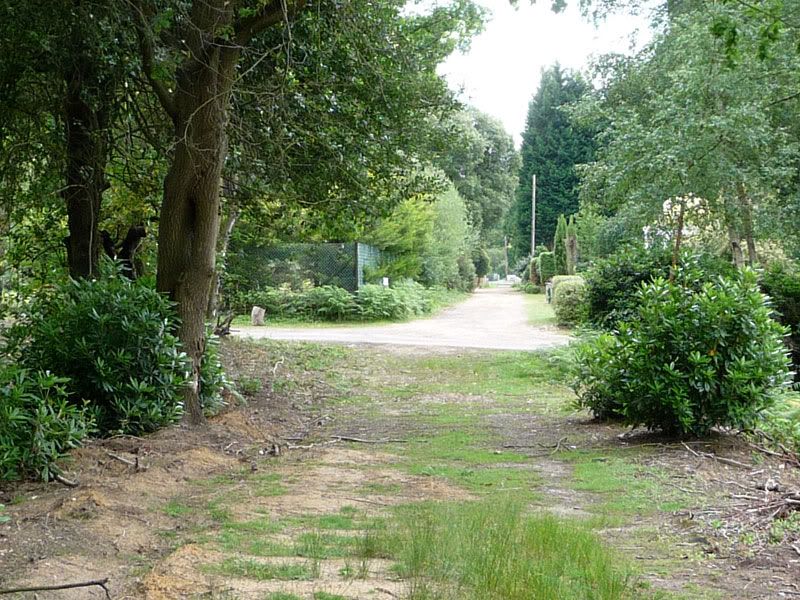
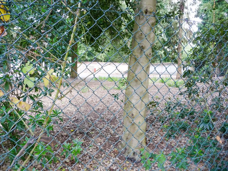
So with the platform on our left - the line continues to a level crossing with Cemetery Pales Road

Image

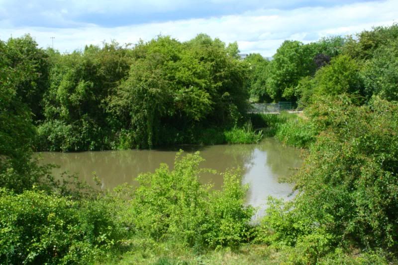
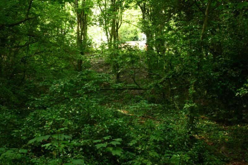
The route was straight ahead and through what is now the big clump of tress and bushes on the other side of the road.

Image

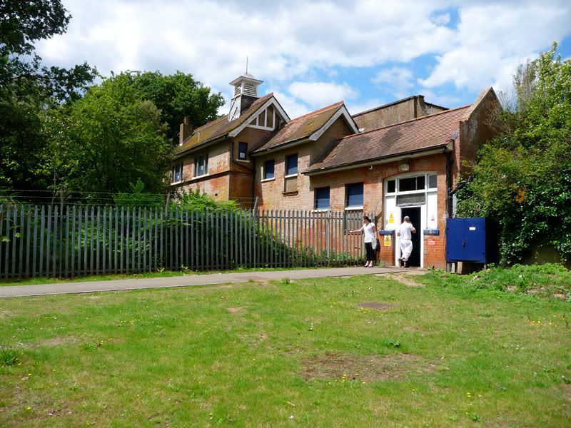
It crossed here, next to a building that was once the Cemetery offices, designed by Sydney Smirke in the 1850s.

Image

Here we are on the other side of the road. I'm to the right of the original route, looking across at where the rails would be right in front of me, and beyond that the siding to the monumental-masons yard.

Image

Image

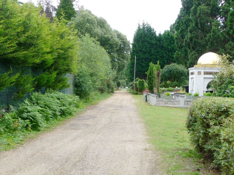
So I continued along the road which runs a few yards to the right of the railway, both of which curve gently around to the left for a quarter mile or so ...

Image

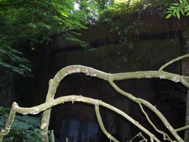
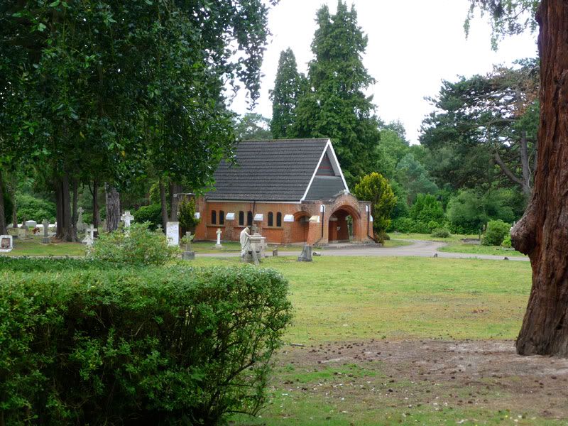
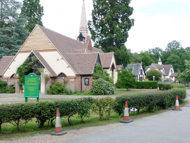
... I knew the South Bar station to be around where this church (1854) is situated ...

Image

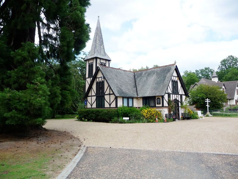
... but two other buildings have sprung up in recent years (another church, and a monastery) - and I feared all trace of the station was lost.

Image

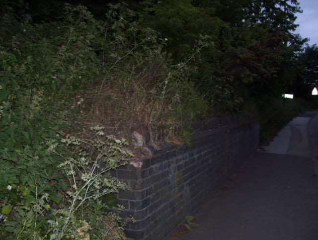
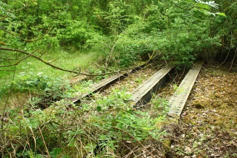
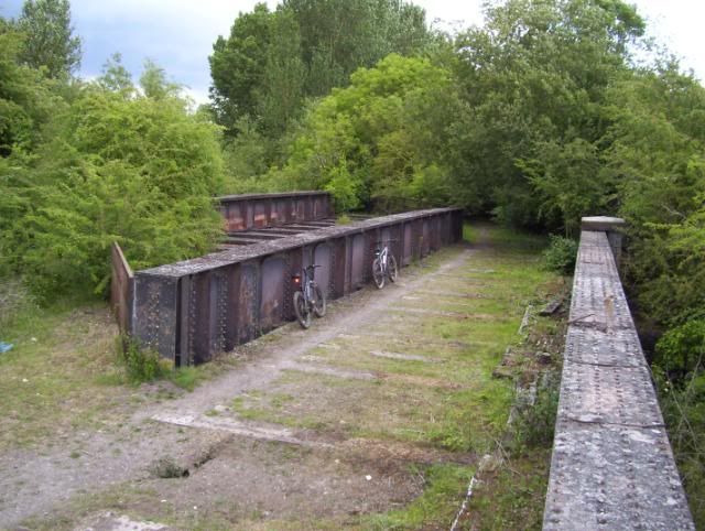
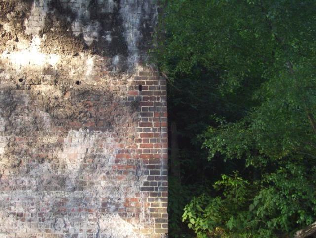
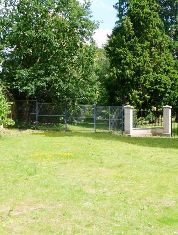
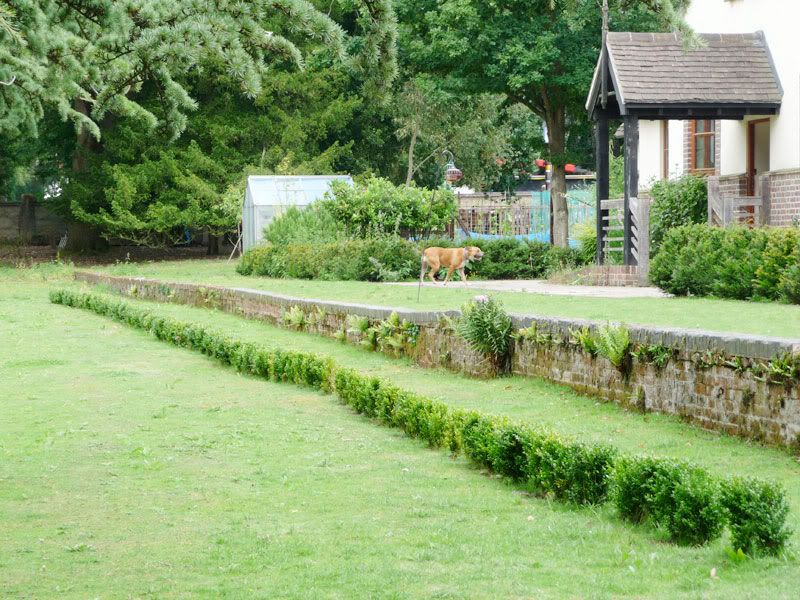
But no, walking round the back I found this ...

Image

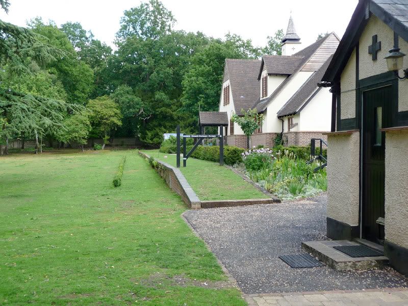
In this second picture you can see the dip in the middle of the platform, which was where bearers removed the coffins from the hearse.

Image

I was delighted to have found at least one large chunk of the railway remaining.

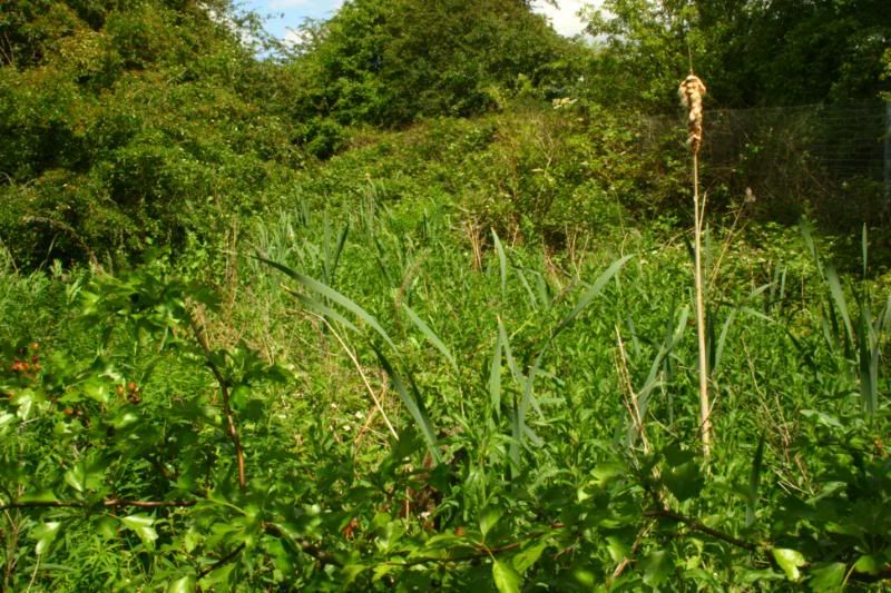
The only thing is, when looking back from the platform along the trajectory of the old line, I realised I may have mis-read the last few hundred yards of the route and must confess to having been distracted by the many wonderful monuments around the place, here are just a few ...

Image

Image

Image

Image

So one day I'll return and retrace those missing last few hundred yards of the route.

But that was enough for one day, refreshment was called for. A short walk through the immaculately maintained Brookwood Military Cemetery and memorial grounds and across Pirbright Village Green brought me to the White Hart ...
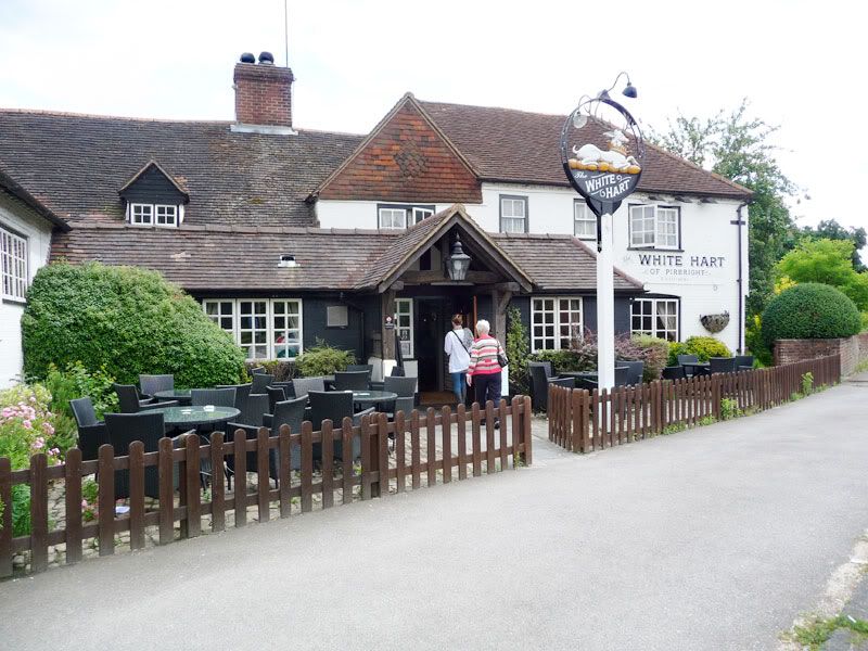
Image

Perfect :)

After a slap-up feed and lashings of, erm, liquid refreshment, I jumped on a train to Waterloo and had another photographic adventure :shock: here :)
Last edited by SouthernBoy on Fri Jul 12, 2013 10:40 pm, edited 2 times in total.
0121modeller
Posts: 1205
Joined: Sun Mar 09, 2008 1:16 am
Location: Erdington, Birmingham,.... but can also be found at various railway bridges !

Re: Inspirations, disused rail routes

Post by 0121modeller »

Yesterday, I decided to re-visit Dudley Old hill to the cutting which leads to the sealed up portal of Haden Hill tunnel Zunnan & myself had previously visited on page 1 of this thread.

The purpose of my re-visit was to gain access to the top of the opposite embankment from where I had decended to gain access into cutting,
Image
I climb the opposite embankment, severely overgrown at the top, I'm still none the wiser the reason for that plate girder bridge was, it heads in the direction of the sawmills that was once a brickworks, so maybe it was a service road that lead to that.

Image
Does anyone know what this is/was ?

Image
A hexagon concrete foundation for something ? , I believe this to be near to the old trackbed..., hard to tell the exact location of the trackbed as all around me is extremely overgrown & the ground very uneven with occasional signs of ballast trace, I had to be carefull not to loose my direction bearings due to the dense vegetation & me being fairly isolated here.

Image
Pop bottles with tubes feeding a brown liquid into the base of wooden fence posts were quite strange, every post had the same device :o anyone know what they're for ? a slow release timber preservative maybe ??

Image
The rear of woodyard premises, I thought it best not to proceed beyond this, so I made my way back down to the cutting, then up & out back to my car.

Image
Approximately 2 miles north of old hill is the disused Parkhead Viaduct, I last visited this 3 years ago, there does'nt seem to be much change in deterioration since the walls have been stabilized with straping girders & tiebars holding the walls together due to the dense overgrowth & bulging undergrowth in the viaduct trackbed, most of the trees & vegetation you can see over the viaduct is'nt a background feature, its trees on the old trackbed!
Back in 1994 soon after the line was closed, I walked the length of this viaduct , its now fenced off both ends & looks severely overgrown.

Image
Looking up at that "H" girder with tie-bar re-enforcement.
20 years ago, this route was going to be converted for a metro tramway from Stourbridge up to Wednesbury, a pity this public transport proposal was abandoned.

Image
Notice the vertical crack line in the brickwork on the RH side of abutment.
Scratchbuilding 4mm scale JXA scrapwagons ; - http://www.newrailwaymodellers.co.uk/Fo ... =6&t=37620
Scratchbuilt & kit built grappler claw cranes ; - http://www.newrailwaymodellers.co.uk/Fo ... =6&t=36342
User avatar
luckymucklebackit
Posts: 3715
Joined: Mon Jul 18, 2011 7:05 am
Location: Eaglesham (Again)
Contact:

Re: Inspirations, disused rail routes

Post by luckymucklebackit »

This site has long been legendary for urban exploration of disused lines

http://www.revival.stormshadow.com/rail ... cg-001.htm

There are lots of photographs of disused urban routes in Glasgow and the surrounding district.

Also worth a look os the site http://urbanglasgow.co.uk, if you go into the forum and search for Buchanan Street there are photographs of the station and approach lines being dismantled.

Jim
This Signature Left Intentionally Blank, but since I have written this and I intended to do it, this Signature is intentionally not blank. Paradox or What?
My layout - Gateside and Northbridge
Image
User avatar
markh
Posts: 1092
Joined: Tue Mar 23, 2010 2:40 pm
Location: Workington

Re: Inspirations, disused rail routes

Post by markh »

There are three or four old railways not to far from where i live ( No4 has recently been lifted)

No1, Workington central railway. from moorclose the railway works it way through the town in to the town center it then runs be hond some shops & on in to seaton

No2, un sure were this line ran to but it ends at the now flattend steel works up over the carlise to barrow line & through thre moddle of saltebeck pass southfeild school & up & i think ot joined the lowca line

No3 lowca line, this railway ran from lowca then up behind harrington then round by high harrington

No4 workington docks to couros steel works, a veryintresting railway which if modeled would have plenty of shunting manovers the railway ran from the steelworks on past clayflats & up to the slagbank the railway then ran on int to a run round loop when then ran on in to the docks via a swing bridge

sorry for not beging well detailed as i dont have my book on the old railways of workington & the workingonton docks - steelworks line is well coved up by trees
THIS IS A BAD IDEA,


BUT IM ALL ABOUT BAD IDEAS
0121modeller
Posts: 1205
Joined: Sun Mar 09, 2008 1:16 am
Location: Erdington, Birmingham,.... but can also be found at various railway bridges !

Re: Inspirations, disused rail routes

Post by 0121modeller »

sorry for not beging well detailed as i dont have my book on the old railways of workington & the workingonton docks - steelworks line is well coved up by trees
You can usually can obtain a fairly good idea of what & where former rail routes local to you took, on google satelite maps a straight-ish line of trees will often indicate a cutting or embankment that the route took, but its easier to find a definate clue to start with such a disused bridge or a disused line that you're already aware of, its interesting to follow that line on google earth (if the line has'nt been completely lifted & built upon). Remember that at some point these disused lines often start, end, or meet up with lines that are in current use, the differences are fairly obvious, but be cautious & do your research beforehand as its dangerous & illegal to mistakenly trespass on rail lines that are in current use as I once found out north of Stourbridge junction !

Reproduction period maps by Alan Godfrey may also be of interest to you, most area's of the UK are covered with a large selection of maps specific to a chosen area.

So when you're out & about, if you see something like an old bridge abutment, make a mental or written note of the road & approximate location with another nearby road as a referance, then enter the name of road on google maps on satelite birdseye view mode.

I've had a quick look on my book entitled ; "British Railway Maps and gazetteer" & there seems to be a fair amount of disused rail routes all around the Workington area.
Scratchbuilding 4mm scale JXA scrapwagons ; - http://www.newrailwaymodellers.co.uk/Fo ... =6&t=37620
Scratchbuilt & kit built grappler claw cranes ; - http://www.newrailwaymodellers.co.uk/Fo ... =6&t=36342
User avatar
markh
Posts: 1092
Joined: Tue Mar 23, 2010 2:40 pm
Location: Workington

Re: Inspirations, disused rail routes

Post by markh »

0121modeller wrote:
sorry for not beging well detailed as i dont have my book on the old railways of workington & the workingonton docks - steelworks line is well coved up by trees
I've had a quick look on my book entitled ; "British Railway Maps and gazetteer" & there seems to be a fair amount of disused rail routes all around the Workington area.
0121 modeller i found the book i was looking for in the shed this morning & the book ie called 'Tracks of the ironmasters, a history of the cleator & workington junction railway' & basiclay gives a well detlaied histor from the opening to the closure of the cleator moor junction to high harrington juction then w'ton central & on to linefoot, the lowca line that joined hat high harington jct
THIS IS A BAD IDEA,


BUT IM ALL ABOUT BAD IDEAS
Post Reply